 ENEA Antarctic Data Center
climatologyMeteorologyAtmosphere
Type of resources
Topics
INSPIRE themes
Keywords
Contact for the resource
Provided by
Formats
Representation types
Update frequencies
status
Scale
-
The Observatory main purpose is to contribute to the monitoring of global climate change monitoring standard meteorological parameters. The automatic weather station AWS Rita is located at Enigma Lake (74° 43′ 30″ S - 164° 1′ 59″ E) at 268 m a.s.l., and has been installed on the 5 january 1993. It acquired, every hour, all year round, the meteorological vaiables of wind velocity, wind direction, temperature, pressure and relative humidity.
-
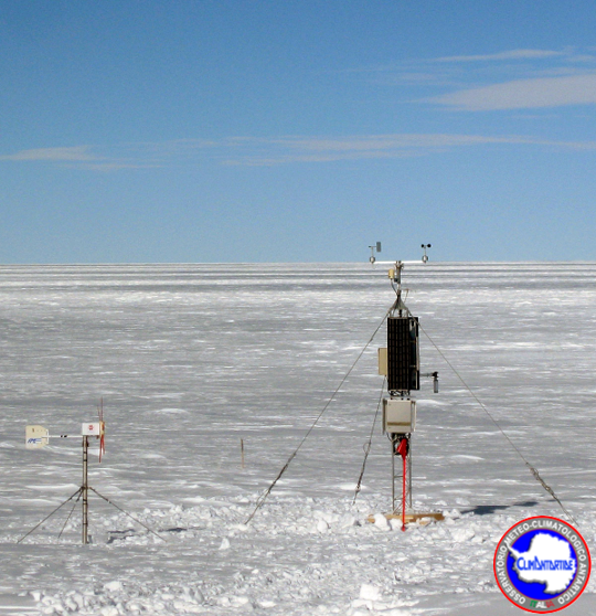
The Observatory main purpose is to contribute to the monitoring of global climate change monitoring standard meteorological parameters. The automatic weather station AWS Giulia is located at Mid Point (75° 32′ 10″ S - 145° 51′ 32″ E) at 2510 m of altitude, and has been installed on the 14 novembre 1998. It acquired, all year round, the meteorological vaiables of wind velocity, wind direction, temperature, pressure, relative humidity and snow height (daily averages).
-
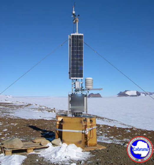
The Observatory main purpose is to contribute to the monitoring of global climate change monitoring standard meteorological parameters. The automatic weather station AWS Sofiab is located at David Glacier (75° 36′ 42″ S - 158° 35′ 26″ E) at 1552 m a.s.l., and has been installed on the 28 november 2002. It acquired, every hour, all year round, the meteorological vaiables of wind velocity, wind direction, temperature, pressure and relative humidity.
-

The project aims to carry out a climatological analysis of the dynamics and structure of the Antarctic polar stratospheric vortex over the last decade 1993-2003 and its relationship with the 'Ozone (O3) hole' phenomenon. In particular will be evaluated all the data from the ground by LIDAR, gained by balloon and by satellite, a high resolution transport model and a GCM model will be used for the climatic characterization of the dynamics of the vortex and its interactions with the polar troposphere and mid-latitudes, and finally a climatology of aerosols and PSCs will be analyzed during the polar winter.
-
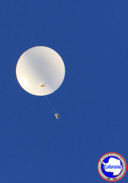
In the frame of YOPP WMO Project, during the Special Observing Period lasting from 16th November 2018 to 15th February 2019, in Concordia and Mario Zucchelli stations daily soundings were executed regularly in DOMEC at 00:00 and 12:00 UTC, and in MSZ another sounding was done at 06:00 UTC and 18:00 UTC. The atmospheric parameters along the vertical profile (upper-air mesaurements) monitored are: height (gps position), pressure, temperature, humidity, velocity of wind, direction of the wind. The RDS (VAISALA RS92) is launched into the atmosphere coupled to a balloon inflated with helium. The sonde rises with a speed of about 2-5 m / s up to a height of between 20 and 25 km. During the ascent all the parameters are acquired. The data obtained are coded both in a digital format (BUFR) and in text format and entered into the global network (GTS) of the World Meteorological Organization (WMO).
-
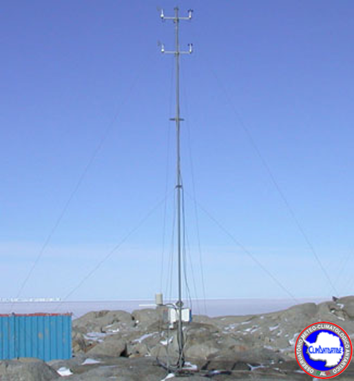
The Observatory main purpose is to contribute to the monitoring of global climate change monitoring standard meteorological parameters. The automatic weather station AWS Jennica was located at Mario Zucchelli Station, in Terra Nova Bay (74° 41′ 40″ S - 164° 7′ 4″ E) at 20 m a.s.l., and has been installed on the 30 December 1999, and has been removed 20 October 2003. It acquired, all year round, the meteorological variables of wind velocity, wind direction, temperature, pressure, relative humidity.
-
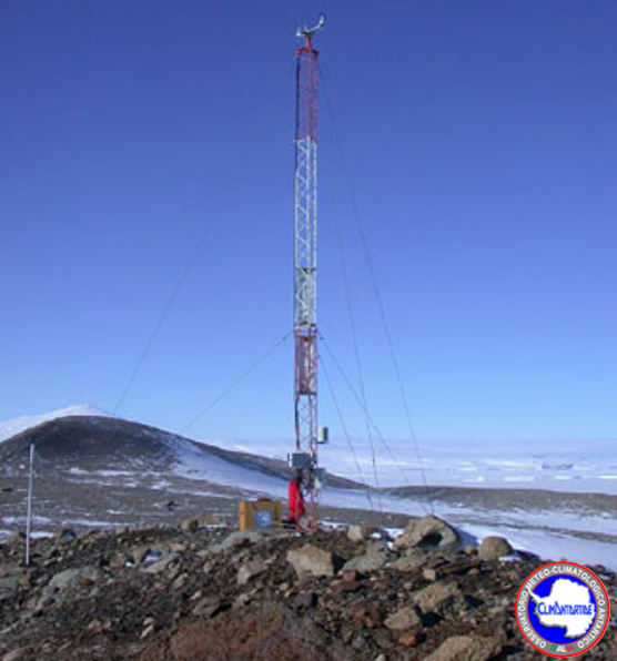
The Observatory main purpose is to contribute to the monitoring of global climate change monitoring standard meteorological parameters. The automatic weather station AWS Silvia is located at Cape Phillips (73° 2′ 60″ S - 169° 35′ 60″ E) at 568 m a.s.l., and has been installed on the 21 december 1990. It acquired, every hour, all year round, the meteorological vaiables of wind velocity, wind direction, temperature, pressure and relative humidity.
-
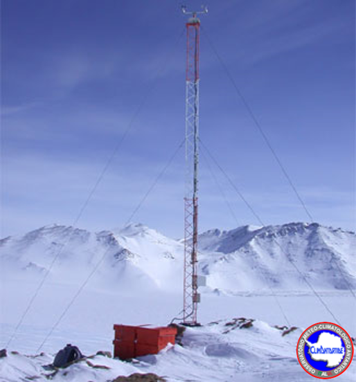
The Observatory main purpose is to contribute to the monitoring of global climate change monitoring standard meteorological parameters. The automatic weather station AWS Lola is located at th Sarao Point (74° 8′ 6″ S - 163° 25′ 50″ E) at 1920 m a.s.l., and has been installed on the 9 January 1991. It acquired, all year round, the meteorological variables of wind velocity, wind direction, temperature, pressure and relative humidity.
-

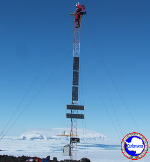
Installation of two radiometers with interference filters (F_RAD) operating in the spectral region from 296 nm to 400 nm. The purpose is to measure the global solar irradiance at the values of the wavelengths where the filters are centered and from these derive the spectral irradiance with a resolution of 0.5 nm. The radiometers are currently positioned in the Antarctic stations of Mario Zucchelli and DomeC Concordia and operate permanently throughout the year. Measurements of absorbance of polysulphone dosimeters before and after exposure to UV solar radiation by laboratory spectrophotometer, data analysis, determination of the UV dose response curve vs absorbance variation and comparison of the results detected in the two sites. It can be used for the measurement of solar UV irradiance for research on the climate and the physics of the atmosphere.
-
The radiosonde MSZ (Mario Zucchelli Station) monitors different atmospheric parameters along the vertical profile. The RDS is located at Mario Zucchelli Station. The climate parameters monitored are: Height (gps position), Pressure, Temperature, Humidity, Velocity of wind, Direction of the wind. The MSZ is active since 15/01/1987. Data are acquired only during the opening season of the Zucchelli station. Daily radiosonde launches (00:00 and 12:00 UTC). During the period from 16 November to the end of the campaign, the radio-sonde of 06 UTC was included as part of the intensive measures campaign of the YOPP project. The RDS (VAISALA RS92) is launched into the atmosphere coupled to a balloon inflated with helium. The sonde rises with a speed of about 2-5 m / s up to a height of between 20 and 25 km. During the ascent all the parameters are acquired. The data obtained are coded both in a digital format (BUFR) and in text format and entered into the global network (GTS) of the World Meteorological Organization (WMO).