 ENEA Antarctic Data Center
AWS
Type of resources
Topics
INSPIRE themes
Keywords
Contact for the resource
Provided by
Formats
Representation types
Update frequencies
status
Scale
-
The project aims to estimate the current mass balance of glaciers and in particular of the Antarctic ice sheet by studying the space-time variations of the balance of snow accumulation through the integration of meteo-climatic and glaciological data. Analysis of weather-climatic and snow measurements collected by AWS stations (Dome C, C3, High Priestley, Talos Dome and a Nansen Ice Sheet) using sensors for measuring snow transport and measuring poles. Snow radar data collection of the Dumont d’Urville-Dome C traverse. Analysis of the chemical and isotopic composition of the collected snow samples. Analysis of satellite data to define the path of the Talos Dome-Dome C-Vostok-Dome B-Dome A crosspiece. High resolution chemical / isotopic analyzes (samples in trenches) for the study of post-depositional diffusion / re-emission processes that occur in the part of the snow closest to the surface. Study of the spatial variability of the snow accumulation at the TD site and along the ITASE traverse. Continuation of the analysis of the samples and geophysical data collected in the previous ITASE traverses.
-

In the MAss LOst in wind fluX (MALOX) project the automatic weather station AWS Virginia purpose is to contribute to the monitoring of global climate change monitoring standard meteorological parameters. The AWS is located at Inexpressible Island (74°56’S 163°41’E) at --- m a.s.l., and has been installed on the ---. It acquired, every minute, all year round, the meteorological vaiables of wind velocity, wind direction, temperature, pressure and relative humidity.
-
The aim of the MAss LOst in wind fluX (MALOX) project is to better understand the phenomenon of snow transport over a coastal area characterized by strong winds. The automatic weather station AWS Lucia purpose is to contribute to the monitoring of global climate change monitoring standard meteorological parameters. The AWS is located at Larsen Glacier, (74° 57′ 2″ S - 161° 46′ 19″ E) at 1350 m a.s.l., and has been installed the 25 january 2007. It acquires, every minute, all year round, the meteorological variables by two sensors for wind velocity and wind direction, two sensors for temperature (at 1 and 3 meters) and for relative humidity, and finally one for atmospheric pressure. Moreover, the AWS acquires further data using radiation sensor (longwave and shortwave), driftometer for the snow transport and height snow sensor.
-
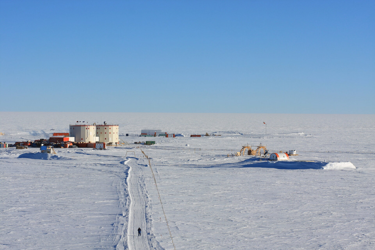
Systematic meteorological observations on the ground and at altitude have been carried out in Concordia station since 2005. Currently, an automatic weather station (AWS Concordia) and a radiosonde system (DomeC) operate continuously all year round. In addition to the standard parameters (temperature, pressure, relative humidity, wind intensity and direction), the AWS integrates an additional sensor (sonic) for measuring the wind. AWS data are transmitted in real time via radio modem and via the Argos system for local storage and display on the intranet and base station. The meteorological data of the AWS and the radiosonde, as well as by the scientific community, are used for local forecasts and for the planning of flight. The transmission of meteorological messages on the international WMO-GTS circuit allows their assimilation into the models, contributing to the improvement of their performances. The acquired meteorological data contribute to the Basic Synoptic Network (WMO) and to the SCAR database (Met-READER). This proposal intends to continue the collection of data for the historical series, for weather-climatic monitoring and to support scientific and operational activities taking place at the base.
-
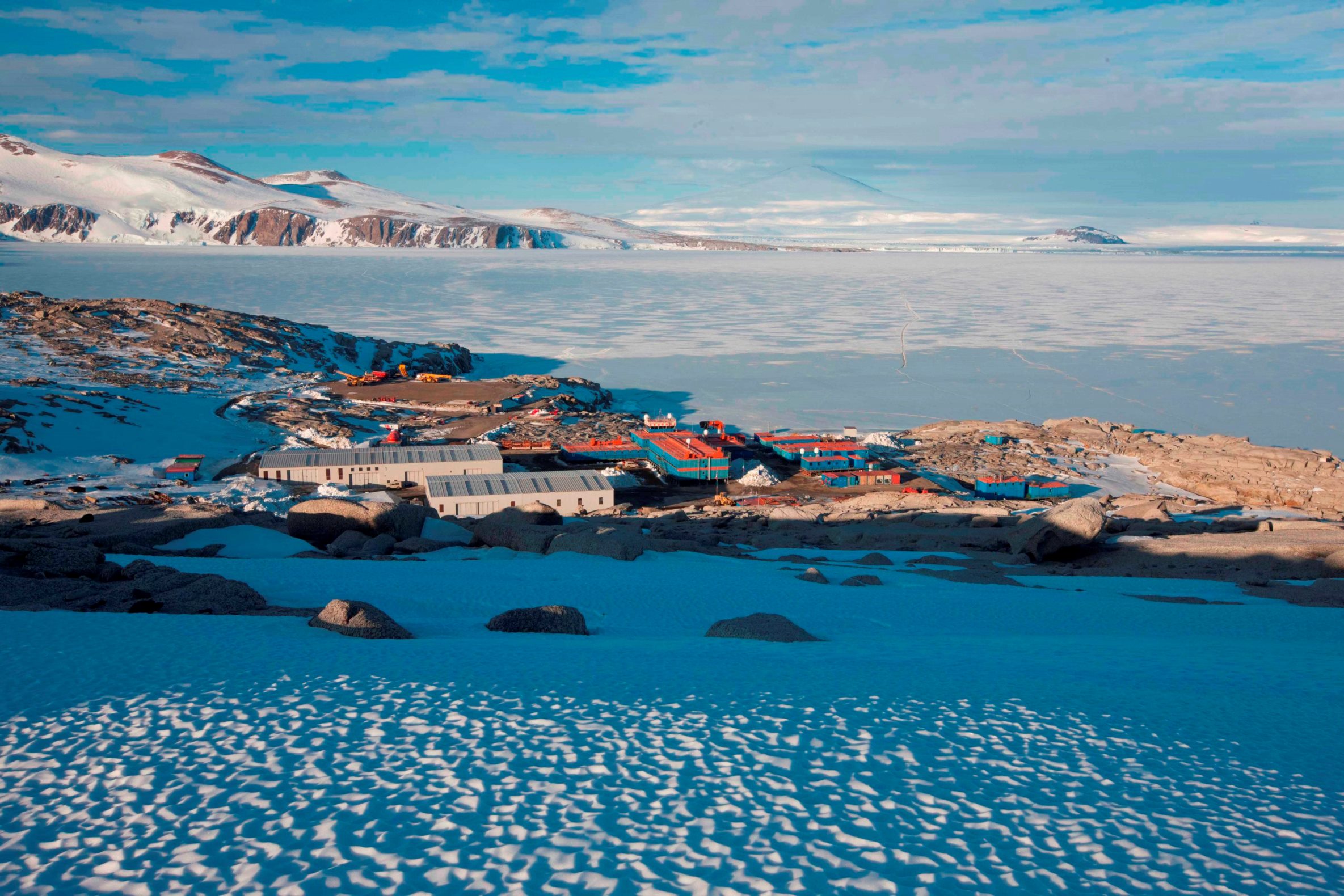
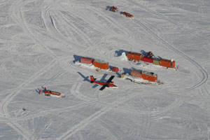
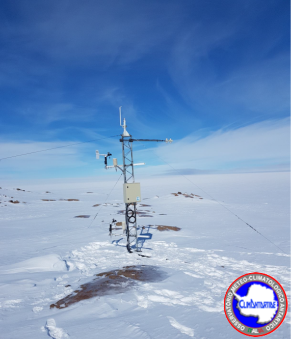
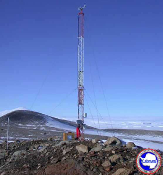
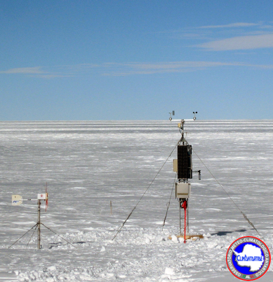
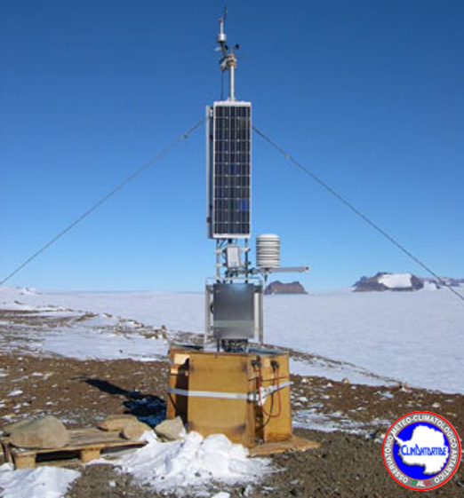
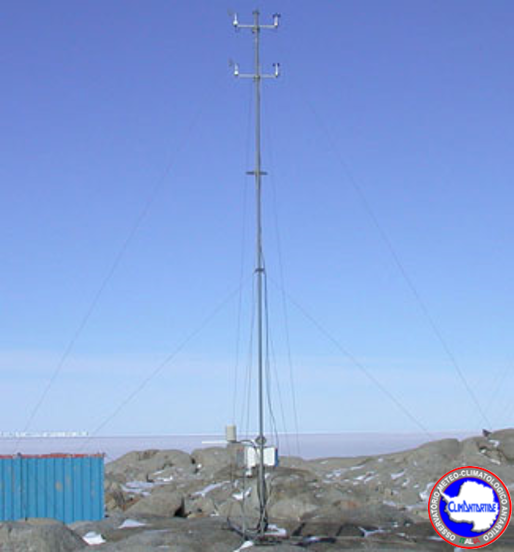
Systematic meteorological observations on the ground and at high altitudes have been carried out in the Mario Zucchelli station (MZS) and Terra Vittoria (TV) since 1987. To date, 15 automatic meteorological stations (AWS) are in operation all year round and, only in summer, a radio sound system, a celiometer for measuring the base of the clouds, a "sky camera" and a rain gauge. Some AWS, besides the standard parameters (temperature, pressure, relative humidity, wind intensity and direction) integrate sensors for radiation overall, the accumulation of snow. Most AWS transmit data in real time via radio modem or iridium to MZS during the summer, and throughout the year via the Argos satellite system. In addition to the scientific community, the data are used for local forecasts and for the planning of flight activities. The transmission of meteorological messages on the international WMO-GTS circuit allows their assimilation into the models, contributing to the improvement of their performances. The acquired data contribute to the Basic Synoptic Network (WMO) and to the SCAR database (Met-READER). This proposal intends to continue data collection for the historical series (up to 28 years of data), for weather-climatic monitoring and as support for scientific and operational activities.
-
The Observatory main purpose is to contribute to the monitoring of global climate change monitoring standard meteorological parameters. The automatic weather station AWS Rita is located at Enigma Lake (74° 43′ 30″ S - 164° 1′ 59″ E) at 268 m a.s.l., and has been installed on the 5 january 1993. It acquired, every hour, all year round, the meteorological vaiables of wind velocity, wind direction, temperature, pressure and relative humidity.
-
The Observatory main purpose is to contribute to the monitoring of global climate change monitoring standard meteorological parameters. The automatic weather station AWS Giulia is located at Mid Point (75° 32′ 10″ S - 145° 51′ 32″ E) at 2510 m of altitude, and has been installed on the 14 novembre 1998. It acquired, all year round, the meteorological vaiables of wind velocity, wind direction, temperature, pressure, relative humidity and snow height (daily averages).
-
The Observatory main purpose is to contribute to the monitoring of global climate change monitoring standard meteorological parameters. The automatic weather station AWS Sofiab is located at David Glacier (75° 36′ 42″ S - 158° 35′ 26″ E) at 1552 m a.s.l., and has been installed on the 28 november 2002. It acquired, every hour, all year round, the meteorological vaiables of wind velocity, wind direction, temperature, pressure and relative humidity.
-
The Observatory main purpose is to contribute to the monitoring of global climate change monitoring standard meteorological parameters. The automatic weather station AWS Jennica was located at Mario Zucchelli Station, in Terra Nova Bay (74° 41′ 40″ S - 164° 7′ 4″ E) at 20 m a.s.l., and has been installed on the 30 December 1999, and has been removed 20 October 2003. It acquired, all year round, the meteorological variables of wind velocity, wind direction, temperature, pressure, relative humidity.