 ENEA Antarctic Data Center
geoscientificInformation
Type of resources
Topics
INSPIRE themes
Keywords
Contact for the resource
Provided by
Formats
Representation types
Update frequencies
status
Scale
-
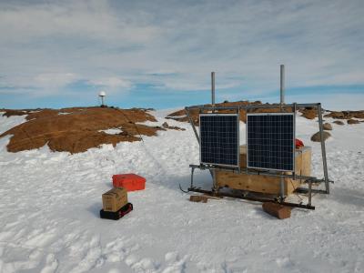
The Geodetic Observatory is based on continuous measurements of GNSS (Global Navigation Satellite System) data for the characterization of the neo-tectonics of a large area of the Northern Victoria Land. Particularly for the definition of a three-dimensional reference (plano-altimetric), and tidal waves, for the definition of a local and global absolute altimetric reference model. The permanent GNSS station 'INXP', has been set on Inexpressible Island (74° 56' 55,1" S - 163° 41' 06,3" E), 32 m a.s.l. during the antarctic campaign 2015 - 2016. INXP records data of GPS and GLONASS constellations, with an acquisition interval equal to 30 s. It is equipped with Tocpon Net-G3 GNSS receivers and chokering antennas, Topcon CR-G5 model (radome TPSH ), installed on steel pillars.
-
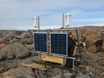
The Geodetic Observatory is based on continuous measurements of GNSS (Global Navigation Satellite System) data for the characterization of the neo-tectonics of a large area of the Northern Victoria Land. Particularly for the definition of a three-dimensional reference (plano-altimetric), and tidal waves, for the definition of a local and global absolute altimetric reference model. The permanent GNSS station 'LRSN', has been set on Mount Larsen (74° 57' 02,0" S - 161° 46' 10,1" E), 948 m a.s.l during the antarctic campaign 2015 - 2016. LRSN records data of GPS and GLONASS constellations, with an acquisition interval equal to 30 s. It is equipped with Tocpon Net-G3 GNSS receivers and chokering antennas, Topcon CR-G5 model (radome TPSH ), installed on steel pillars.