 ENEA Antarctic Data Center
environment
Type of resources
Topics
INSPIRE themes
Keywords
Contact for the resource
Provided by
Formats
Representation types
Update frequencies
status
Scale
-
The project aims to estimate the current mass balance of glaciers and in particular of the Antarctic ice sheet by studying the space-time variations of the balance of snow accumulation through the integration of meteo-climatic and glaciological data. Analysis of weather-climatic and snow measurements collected by AWS stations (Dome C, C3, High Priestley, Talos Dome and a Nansen Ice Sheet) using sensors for measuring snow transport and measuring poles. Snow radar data collection of the Dumont d’Urville-Dome C traverse. Analysis of the chemical and isotopic composition of the collected snow samples. Analysis of satellite data to define the path of the Talos Dome-Dome C-Vostok-Dome B-Dome A crosspiece. High resolution chemical / isotopic analyzes (samples in trenches) for the study of post-depositional diffusion / re-emission processes that occur in the part of the snow closest to the surface. Study of the spatial variability of the snow accumulation at the TD site and along the ITASE traverse. Continuation of the analysis of the samples and geophysical data collected in the previous ITASE traverses.
-
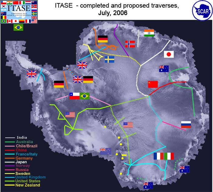
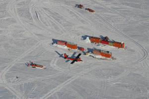
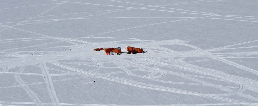
It is a program that, by means of surface crossings thousands of kilometers long, collects information on the behavior of the ice sheet and the related changes in the global sea level as a result of climatic and environmental changes over the last 200 years. Aims of the projects are: Determine the environmental variability in Antarctica over the last 200 yrs, and where the data are available the last 1000 years. Environmental proxies could include: sea ice variation, ocean productivity, anthropogenic impacts; and other, extra-Antarctic continental influences
-
The project aims to estimate the current mass balance of glaciers and in particular of the Antarctic ice sheet by studying the space-time variations of the balance of snow accumulation through the integration of meteo-climatic and glaciological data. Analysis of weather-climatic and snow measurements collected by AWS stations (Dome C, C3, High Priestley, Talos Dome and a Nansen Ice Sheet) using sensors for measuring snow transport and measuring poles. Snow radar data collection of the Dumont d’Urville-Dome C traverse. Analysis of the chemical and isotopic composition of the collected snow samples. Analysis of satellite data to define the path of the Talos Dome-Dome C-Vostok-Dome B-Dome A crosspiece. High resolution chemical / isotopic analyzes (samples in trenches) for the study of post-depositional diffusion / re-emission processes that occur in the part of the snow closest to the surface. Study of the spatial variability of the snow accumulation at the TD site and along the ITASE traverse. Continuation of the analysis of the samples and geophysical data collected in the previous ITASE traverses.
-
The project aims to determine the mass balance components in the Dome C drainage area and to study and monitor local glaciers in Victoria Land. The goal is to define the mass balance of the ice cap through the analysis of its altimetric variation with satellite systems and through the determination of the values of the positive (snow accumulation) and negative (flow of glaciers to the anchor line) components of the balance mass. Trought the study of the snow cores (collected as part of the ITASE project (XVII/XVIII expedition)), was determined the annual stratigraphy and evaluated the snow accumulation, the isotopic temperature and the chemical composition of the snow cores. Moreover analysis of geophysical data (GPR, GPS, RES, spectroradiometry) and remote sensing data were carried out for the study of the variability of snow accumulation, of the dynamics of the ice cap and of the flow of glaciers to the anchor line.
-
The IPICS-2kyr-Italia project, through multiple perforations in the Antarctic ice sheet, aims to provide new data on climatic variability over the last 2000 years. The ice caps are natural archives of the Earth's climatic and environmental history. The extraction of snow and ice cores have taken place during the summer Antarctic campaign (November 2013 - January 2014). The drilling site GV7 (70°41'S, 158°52'E; 1950 m), was chosen for the high snow accumulation and was located about 500 km from Mario Zucchelli Station.
-

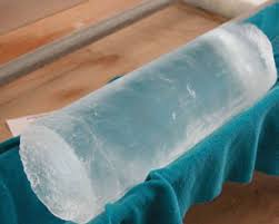
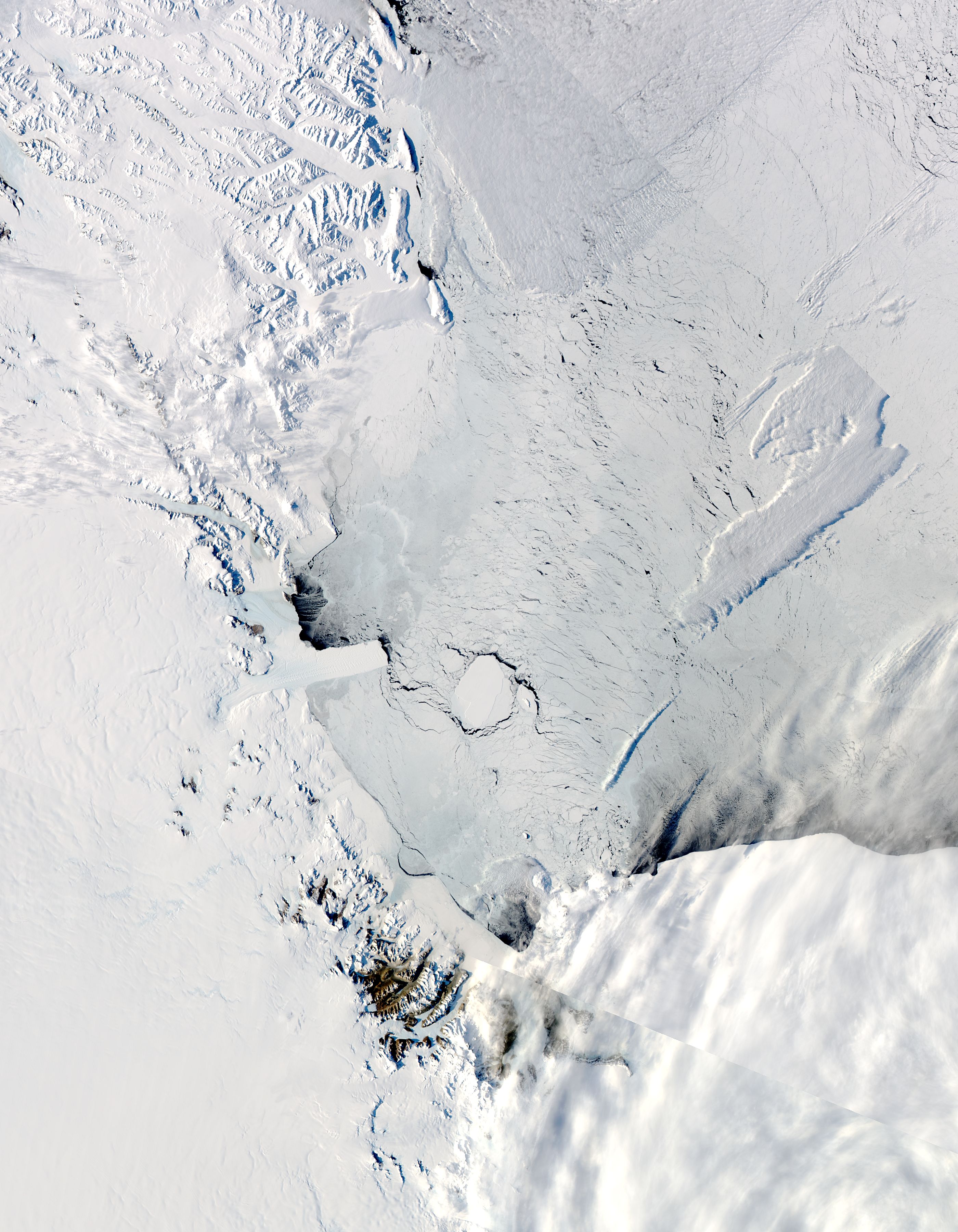
The TALos Dome Ice CorE (TALDICE) is a European ice core research project (Italy, France, Germany, Switzerland, United Kingdom) aimed at retrieving an ice core reaching back through the previous two interglacials (about 250,000 years), from a peripheral dome of East Antarctica, and want to reconstruct a reliable chronology, thanks to the presence of numerous layers of volcanic dust given the proximity of several volcanoes. Talos Dome is an ice dome (159°11'E - 72°49'S, 2316 m asl) on the edge of the East Plateau of Antarctica, about 290 km from the Southern Ocean, 250 km from the Ross Sea, 275 km from Mario Zucchelli Station, 550 km North of Taylor Dome , 1500 km NW of Simple Dome, and 1100 km East of Dome C. The TALDICE project started in the field in November 2004 and ended on December 23, 2007, at the final depth of 1620.20 m. Ice Thickness 1795 m Mean annual temperature -41°C Mean annual atmospheric air pressure 721±10 hPa Ice velocity 0.14 m yr-1
-
The aim of the MAss LOst in wind fluX (MALOX) project is to better understand the phenomenon of snow transport over a coastal area characterized by strong winds. MALOX relies on a multi-disciplinary approach based on both in situ and remote sensing measurements. Satellite data (MODIS, CALIPSO) analysis will provide spatial and vertical extension of the transport phenomenon. In situ microphysical, thermodynamic, and radiative observations will be aimed at determining the surface and column integrated water content, and characterizing the wind flux at local scale during the summer. Observations will be carried out also during the winter period to observe stronger transport events and to create a complete dataset which will provide a qualitative estimate of the mass loss due to blowing snow sublimation through the difference between the water content measured at two sites along the main wind path on steep slopes, one upstream of the convergence zone of the katabatic flux (Larsen Glacier, LS, 74°57'S 161°46'E) and the other downstream, near the coast (Inexpressible Island, InS, 74°56’S 163°41’E).
-
Data of the precipitation fallen during the summer months (November-December-January) on four expeditions, 2015-16, 2016-17, 2017-18, and 2018-19, in the Terra Nova Bay area, were obtained using a vertically pointing radar, disdrometer and snow gauge. The vertical pointing METEK Micro Rain Radar 2 (MRR) was installed in MZS at the end of November 2015. It records Doppler velocity spectra every 10 s at 32 range gates. The radar gate spacing was set to 100 m allowing the profiler to sound heights ranging from 100 to 3100 m above the surface. The raw K-band power spectra, collected by the MRR, were processed applying the method proposed by Maahn and Kollias (2012) to correct for noise and aliasing effects, making them suitable for snow observation. A Thies CLIMA laser disdrometer (LPM), has been operational since December 2014.The disdrometer can simultaneously count and measure the size and fall velocity of hydrometeors. A Total Rain weighing Sensor (TRwS) manufactured by MPS system was installed during the december 2018 - January 2019 campaign within the YOPP observing period. The TRwS is a total rain/snowfall weighing gauge with an orifice area of 400 cm2, a depth accuracy of 0.01 mm of w.e. and a one -minute sampling time resolution (Savina and others, 2012). The TRwS was protected by an alter shield in order to minimize wind effect over the accumulation inside the instrumentation.
-

The Ice-ClimaLizer research investigates the role of two Antarctic bioconstructional and bioindicator organisms (bryozoan and coralline algae), responsible of promoting marine biodiversity, as proxies of environmental conditions (temperature, light intensity, pressure, oxygen, conductibility and pH). An experimental laboratory has been placed in Tethys Bay (Ross Sea) at 25.5 m deep. The project will compare 1 year of environmental data obtained via continuous recording (every hour) by CTD probe with reconstructed data obtained via geochemical proxies of skeletons/thalli of the investigated species. Data are collected from November 2018 to November 2019.