 ENEA Antarctic Data Center
climatologyMeteorologyAtmosphere
Type of resources
Topics
INSPIRE themes
Keywords
Contact for the resource
Provided by
Formats
Representation types
Update frequencies
status
Scale
-

In the MAss LOst in wind fluX (MALOX) project the automatic weather station AWS Virginia purpose is to contribute to the monitoring of global climate change monitoring standard meteorological parameters. The AWS is located at Inexpressible Island (74°56’S 163°41’E) at --- m a.s.l., and has been installed on the ---. It acquired, every minute, all year round, the meteorological vaiables of wind velocity, wind direction, temperature, pressure and relative humidity.
-
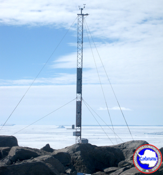
The Observatory main purpose is to contribute to the monitoring of global climate change monitoring standard meteorological parameters. The automatic weather station AWS Arelis is located in Cape Ross (76° 42′ 54″ S - 162° 58′ 12″ E) at 150 m of altitude, and has been installed on the 21 January 1990. It acquired, all year round, the meteorological vaiables of wind velocity, wind direction, temperature, pressure and relative humidity.
-
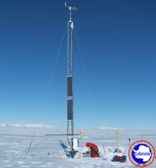
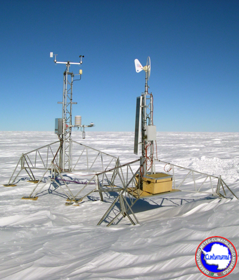
The aim of the MAss LOst in wind fluX (MALOX) project is to better understand the phenomenon of snow transport over a coastal area characterized by strong winds. The automatic weather station AWS Lucia purpose is to contribute to the monitoring of global climate change monitoring standard meteorological parameters. The AWS is located at Larsen Glacier, (74° 57′ 2″ S - 161° 46′ 19″ E) at 1350 m a.s.l., and has been installed the 25 january 2007. It acquires, every minute, all year round, the meteorological variables by two sensors for wind velocity and wind direction, two sensors for temperature (at 1 and 3 meters) and for relative humidity, and finally one for atmospheric pressure. Moreover, the AWS acquires further data using radiation sensor (longwave and shortwave), driftometer for the snow transport and height snow sensor.
-
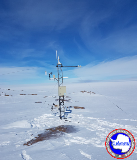
The Observatory main purpose is to contribute to the monitoring of global climate change monitoring standard meteorological parameters. The automatic weather station AWS Modesta is located on the Priestley Nèvè (74° 37′ 35″ S - 164° 0′ 40″ E) at 1924 m a.s.l., and has been installed on the 1 February 1989. It acquired, every hour, all year round, the meteorological vaiables of wind velocity, wind direction, temperature, pressure and relative humidity, plus snow height acquired as daily averages.
-
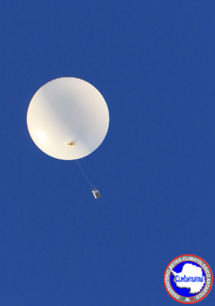
In the frame of YOPP WMO Project, during the Special Observing Period lasting from 16th November 2018 to 15th February 2019, in Concordia and Mario Zucchelli stations daily soundings were executed regularly in DOMEC at 00:00 and 12:00 UTC, and in MSZ another sounding was done at 06:00 UTC and 18:00 UTC. The atmospheric parameters along the vertical profile (upper-air mesaurements) monitored are: height (gps position), pressure, temperature, humidity, velocity of wind, direction of the wind. The RDS (VAISALA RS92) is launched into the atmosphere coupled to a balloon inflated with helium. The sonde rises with a speed of about 2-5 m / s up to a height of between 20 and 25 km. During the ascent all the parameters are acquired. The data obtained are coded both in a digital format (BUFR) and in text format and entered into the global network (GTS) of the World Meteorological Organization (WMO).
-
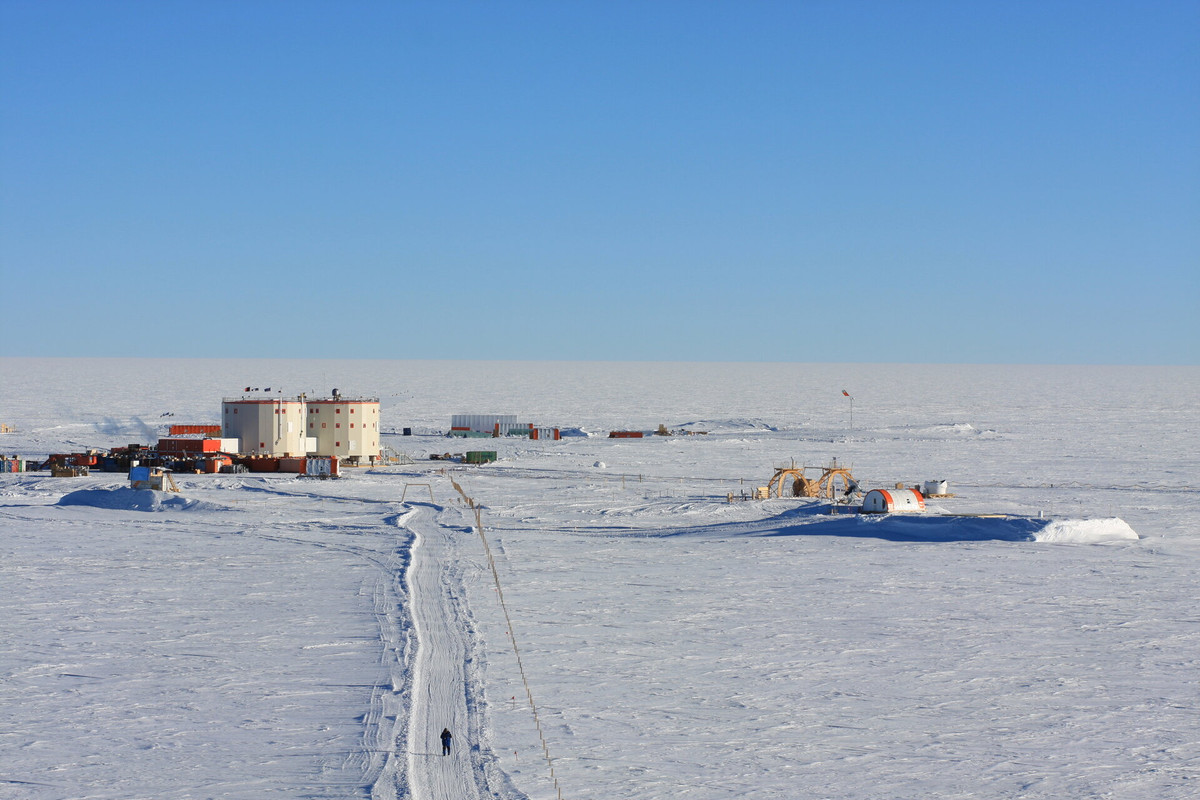
Systematic meteorological observations on the ground and at altitude have been carried out in Concordia station since 2005. Currently, an automatic weather station (AWS Concordia) and a radiosonde system (DomeC) operate continuously all year round. In addition to the standard parameters (temperature, pressure, relative humidity, wind intensity and direction), the AWS integrates an additional sensor (sonic) for measuring the wind. AWS data are transmitted in real time via radio modem and via the Argos system for local storage and display on the intranet and base station. The meteorological data of the AWS and the radiosonde, as well as by the scientific community, are used for local forecasts and for the planning of flight. The transmission of meteorological messages on the international WMO-GTS circuit allows their assimilation into the models, contributing to the improvement of their performances. The acquired meteorological data contribute to the Basic Synoptic Network (WMO) and to the SCAR database (Met-READER). This proposal intends to continue the collection of data for the historical series, for weather-climatic monitoring and to support scientific and operational activities taking place at the base.
-
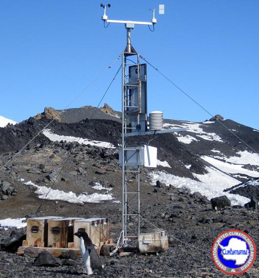
The Observatory main purpose is to contribute to the monitoring of global climate change monitoring standard meteorological parameters. The automatic weather station AWS penguin is located at Edmonson Point (74° 20′ 0″ S - 165° 8′ 0″ E) at 30 m of altitude, and has been installed 3 December 1998. It acquired every 10 minutes, only during the opening season of the activities in MSZ station, the meteorological variables of wind velocity, wind direction, temperature, pressure, relative humidity and solar radiation.
-
The Observatory main purpose is to contribute to the monitoring of global climate change monitoring standard meteorological parameters. The automatic weather station AWS Irene is located at Sitry on the antarctic plateau (71° 39′ 9″ S - 148° 39′ 20″ E) at 2094 m a.s.l., and has been installed on the 3 Decmber 2001, and has been removed 24 November 2016. It acquired, all year round, the meteorological variables of wind velocity, wind direction, temperature, pressure, relative humidity and solar radiation. The aws also monitored daily avarages of snow height.
-
Monitoring of climate data in the area of the Concordia station, at Dome C, from the XXXIV Antarctic campaign using radiosonde system (RDS) DOMEC. The climate parameters monitored are: Height (gps position), Pressure, Temperature, Humidity, Velocity of wind, Direction of the wind. The data are obtained doing upper-air measurements. Data are collected every day at 12UTC, all year round. The DOMEC is active since 2006-01-19. The RDS (VAISALA RS92) is launched into the atmosphere coupled to a balloon inflated with helium. The sonde rises with a speed of about 2-5 m / s up to a height of between 20 and 25 km. During the ascent all the parameters are acquired. The data obtained are coded both in a digital format (BUFR) and in text format and entered into the global network (GTS) of the World Meteorological Organization (WMO).
-
The project is focused on the acquisition of data using the MZS_FRAD2008-02 interference filter radiometer, installed in November 2009 at Mario Zucchelli station, on the roof of the building OASI (74°41.6059' S 164°05.9423' E). The radiometer is active all year round and measures the global solar irradiance (watt / m2nm) at the values of 9 different wavelengths (about one spectrum per minute), where the filters are centered, and obtained from these the measure of the spectral irradiance with a resolution of 0.5 nm. The data is transferred to Italy on a daily basis via an Ethernet link. Data are acquired in the summer station of MZS from November 2009 to May 2013.